


"This is evidence as far as we are concerned for planning terrorist attacks," said an intelligence officer with the Royal Green Jackets battle group. "Who would otherwise have Google Earth imagery of one of our bases?"
Well, as a point of fact - not that anyone appears to care much about facts anymore unless, of course, they're celebrity facts - and in response to the question, "Who would otherwise have Google Earth imagery of one of our bases?" - the answer is: Lots of people, such as those who want to know what all their tax money is being spent on and including those nice folk over at The Register and their 'terrorist' readers who ran and participated in a competition to - guess what - see who could find the most interesting parts of the world, hidden within Google Earth satellite imagery. For example, the following comes from, "Spot the black helicopter":
It doesn't end there, though. Donald Massyn notes:I found this collection of black helicopters at the Basra airforce base in Iraq, which probably means they're British!! (and I though it was only the Yanks who belong to the black chopper brigade).

 Amazingly enough, the entire readership of The Register, by focussing their mapping efforts on looking for U.S. military bases around the world, with or without black helicopters and alleged alien landing pads, missed out on one or two little architected-into-the-earth gems, the existence of which everyone should know about for their pointers to another world of history contained within the conventional study of history that only makes itself apparent if, and when, the ability to be able to perceive previously obscured evidence in its correct historical, physical and temporal context makes itself available.
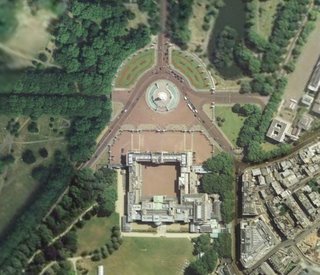
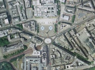
Which it eventually does, because there ain't no putting the genie back in the bottle, no matter how great the forces that conspire against it. Enter GoogleMaps, Buckingham Dollar Bill Pyramid Palace and Trafalgar Square's Jolly Roger, the latter of which being the traditional flag of all pirates).
So, while Google Earth is showing the world high-quality satellite imagery of the world, including the land of Pirate Ship Britain - for free - and leaving everyone to wonder what resolution images the military are watching over the rest of us with, the military think it's a bad idea if ordinary people can explore the bluey-green planet upon which most people generally try and do their best to happily and peacefully coexist with one another, while another group - a much smaller and much more pernicious group - endeavours to make everything so the only method of survival available to normal, decent people is to live in a way that is exactly opposite to the one which would be best for themselves and everyone else.

When everything has truly become its opposite, and there is evidence in the public domain to suggest that everything isn't quite as it is portrayed to be, you know that drastic changes are a-coming.


No comments:
Post a Comment